Cache County Logo
 Home  Departments  News  Services  Meetings  Council  Code  Jobs
Slideshow Image 3
Slideshow Image 8
Slideshow Image 6
Slideshow Image 10
Slideshow Image 4
Slideshow Image 2
Slideshow Image 12
Slideshow Image 9
Slideshow Image 11

  •  Development Services
  •  GIS - Mapping Home

  • Cache Drainage Districts
  • Canal Maps
  • FAQs
  • GIS Data Downloads / Static Maps
  • Interactive Web Maps
  • Offline Trails Map
  • Plats, Imagery, Topo Maps
  • Rapz Tax Projects Viewer
  • Road Maps
  • Staff
  • Surveyor's Office
  •  Contact

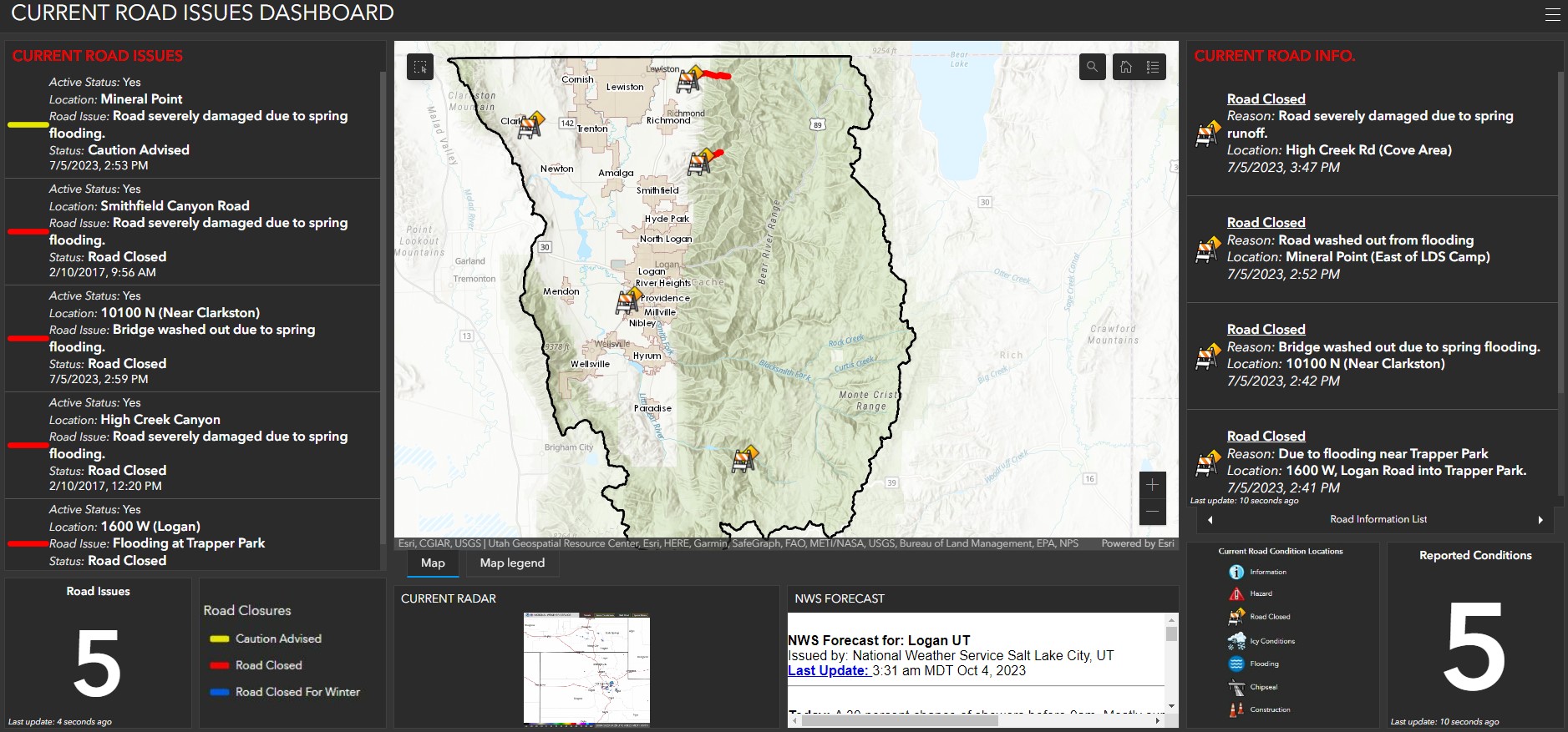
Road Closures Viewer


Description

This map contains information about road closures. The data contained in this map is updated as road closures change. Questions about the maps functionality or map data please contact the GIS staff. 


Click below for instructions on how to clear a web browser's cache                                     

http://www.refreshyourcache.com/en/home/


                                                     Click on Map to Enter Viewer

Image of the Road Closures Viewer


Disclaimer

The data presented in the various interactive maps are not legally binding on the County or any of its departments.


These maps and the associated data are REPRESENTATIONS ONLY and may contain errors in geometry, the databases or anything else. Therefore the information presented on this website should not be construed to be legally binding. The maps are for informative purposes only.


To view the document(s) or web map(s) above, you must have Adobe Reader and/or Flash Player.


get adobe reader  get flash player

This web map is built for iOS and Android  or Windows  


Bigger Cache County Logo
179 N Main & 199 N Main
Logan, UT 84321
Report Page
Help us improve
© 2023 Cache County

CORE logo
County Outreach